Geocaching is a modern treasure hunt that blends outdoor adventure with technology, using GPS to locate hidden “caches.” It’s more than just a hobby—it’s a global community of explorers.
Today, this pastime has evolved from handheld GPS units to drone-assisted hunts. Drones add excitement and precision to geocaching. This guide explores how geocaching drones work, their features, benefits, and challenges, plus tips and drone recommendations to help you begin your journey.
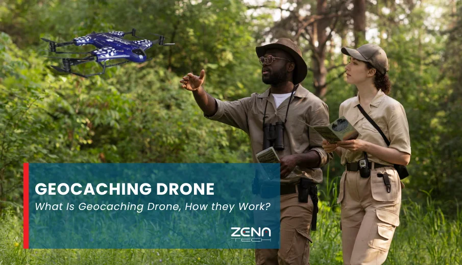
What Is a Geocaching Drone?
A geocaching drone is a GPS-enabled aerial device built to locate, place, or document geocaches from the air. It helps geocachers explore areas that are difficult, time-consuming, and even dangerous to navigate on foot.
It scans different terrains, like thick forests, steep mountain trails, or riverbanks. Moreover, it also allows you to capture picturesque views while marking coordinates for your fellow geocachers.
Drone geocaching delivers a more efficient and immersive experience for all your geocaching adventures.
How Geocaching Drones Work: The Basic Mechanism
Drones elevate geocaching to reach new heights–both literally and figuratively. But how? Let’s take a look at that.
- GPS Coordinates, Sensors, and Cameras: GPS modules are the heart of geocaching drones, guiding flight paths and helping locate caches autonomously. Advanced sensors and high-resolution cameras stabilize flight and capture stunning 4K visuals—key to precise navigation and exploration.
- FPV (First-Person View): What makes drone geocaching exciting is its FPV capabilities, which enable live exploration. It allows geocachers to “fly” and see what the drone sees, creating a more immersive experience.
- AI Integration: This feature is yet another fascinating drone geocaching technology. It supports object tracking and terrain mapping using algorithms to locate caches rapidly, although it is often available only in advanced drones.
With these mechanisms, drones can help locate and document caches over vast areas while delivering crucial data and aesthetic photos.
Components and Features of a Geocaching Drone
Geocaching requires you to venture into remote, rugged, and sometimes unexplored areas. Precision, durability, and adaptability are non-negotiable for treasure hunts.
To perform effectively in outdoor exploration, geocaching drones are equipped with:
- GPS Module: Ensures accurate navigation, waypoint tracking, and marking newfound spots.
- High-Resolution Camera: Captures clear imagery and aerial documentation to spot possible cache locations.
- Obstacle Avoidance Sensors: Prevent accidents in tight spaces, such as dense forests, rocky terrain, and uneven slopes, by automatically adjusting the flight path.
- Flight Controller: Acting as the “brain” of the drone, they process data from GPS, sensors, cameras, and inputs to stabilize flight and process commands.
- Long-Lasting Battery: Supports extended mapping missions and long-distance searches.
These features ensure the drone’s stability, range, and battery life for extended geocache hunts – three essential factors for success.
- Stability guarantees drone performance, helping it maintain clear visuals, precise positioning, and responsive controls.
- An extended transmission range lets you explore farther without losing control and signal.
- Longer battery life enables extended flights, letting pilots cover more ground efficiently.
Considering these points makes your geocaching experience even more thrilling and worthwhile.
Benefits of Using Drones in Geocaching
With all the mechanisms and features, drones are pretty helpful for geocaching. But how exactly do drones help in geocaching?
- Easily access challenging terrain, from mountains and rivers to sheer cliffs, forests, and other hard-to-reach areas.
- Save time locating caches from an aerial view with a quick swoop from drones that manually takes hours or even days.
- Capture high-quality visuals and improve mapping accuracy so you can focus more on the expedition and less on the headaches.
- Enhance adventure, collaboration, and creativity in the hobby by sharing your experiences and locations with your fellow enthusiasts.
Drones enhance the overall experience of geocaching, not just on the technical side but also on the sense of wonder and leisure. That’s something geocachers would surely love.
Limitations and Challenges
Understanding the drawbacks of geocaching drones is just as important as knowing their benefits, as it lets you prepare countermeasures. Follow along to learn more.
Battery and Range Constraints
Long treasure hunts may require extra batteries or planned charging stops.
Environmental Interference
Bad weather, dust, and magnetic fields can disrupt flight stability.
Connectivity Issues
Places with weak signals and obstructions affect GPS precision, maneuverability, and data transmission.
Legal and Ethical Concerns
Flying too close to wildlife, people, or restricted zones can cause problems.
Awareness of these factors helps ensure every flight is safe, responsible, and enjoyable.
Legal and Safety Considerations
Beyond all the fun and adventure, it’s essential not to forget to follow local and international drone regulations to avoid legal, safety, and financial problems.
Also, here are some tips to help you fly responsibly:
- Maintain visual line-of-sight when flying. It lets you better monitor your drone’s trajectory and keeps it from crashing into obstacles.
- Observe altitude limits (usually under 400 feet or 120 meters).
- Avoid no-fly and restricted zones and geofenced areas.
- Respect privacy, nature, and property boundaries.
Responsible drone geocaching is crucial to keeping the hobby safe and sustainable. For that, be sure to check official geocaching and aviation authority websites for restrictions in your area before each flight.
How to Get Started with Drone Geocaching
You’ve learned everything there is to know about geocaching drones. You can start thinking about actually doing it.
If you’re new to this, here’s how to begin:
- Choose a GPS-enabled drone with stable flight performance, long-lasting batteries, high-resolution cameras, and sensors.
- Download Geocaching and Mapping Apps, such as Geocaching® and Google Earth.
- Practice flying in open spaces. Doing so lets you learn the controls, basic maneuvers, and how to avoid obstacles safely.
- Learn local drone laws before exploring new areas to save you from legal and financial risks.
- Join geocaching communities online or locally to exchange tips, coordinates, or socialize to make your hobby more enjoyable.
- Record responsibly and ensure that you never invade private or restricted spaces. Share videos and photos without revealing exact cache locations to keep the thrill for everyone.
Geocaching is a fun outdoor hobby that rewards your adventures and explorations with exciting treasures. But it’s definitely not very easy. Take it slow and start small, learning and building experience.
Best Drones for Geocaching
It’s time to look at the best drone models to take with you on your next geocaching adventure:
ZenaDrone 1000
ZenaDrone 1000 is an enterprise-grade drone built for long endurance, AI mapping, and obstacle avoidance. It’s ideal for serious explorers due to its independent aerial surveillance, heavy-duty batteries, intelligent flight modes, and advanced multispectral sensors.
ZenaDrone IQ Nano
The IQ Nano is highly agile and maneuverable thanks to its compact, lightweight design. Its sensor and camera integrations, along with precise drone GPS navigation for autonomous flights, make it perfect for geocache hunts in tight spaces.
Zenadrone IQ Square
The IQ Square is ideal for commercial and recreational uses with its built-in LiDAR, thermal, and HD imaging. Thanks to its versatile capabilities and intuitive controls, it’s a top choice for complex mapping tasks and terrain detection.
Choosing the right drone is key to streamlining geocaching and achieving a top-tier experience. That said, these drones are built with safety, precision, and reliable performance in mind for casual and serious geocachers.
The Future of Geocaching Drones
With the continued rise of drone geocaching technology, the future is projected to become even more exciting.
AI-driven navigation is becoming more reliable and will one day provide directions, taking you straight to your sought-after treasures.
Swarm drones can simultaneously map out broad areas and rugged terrain to give you an instant view of the environment.
Augmented Reality (AR) also delivers real-time information and a virtual perspective. It enhances situational awareness, waypoint planning, and drone operator experience.
Finally, constant innovations are also set to enrich predictive mapping and drone cooperation for team-based geocaching.
These will make searches and explorations faster, cooler, and simpler, and it won’t be long until geocaching becomes more immersive and interactive through the use of drones.
Conclusion
Drones blend technology and adventure to redefine geocaching, offering even more efficiency and excitement. Even so, you do need to find the right drone first.
Fortunately, ZenaTech provides reliable and adaptable companions for you, ensuring an experience for the books.
However, here’s a quick and friendly reminder: fly responsibly, adhere to the laws, and respect nature.
Geocaching drones open up a fresh, thrilling world, but they’re not everything. After all, technology may guide the path, but adventure lies in discovery.