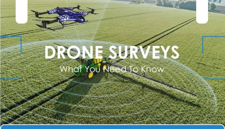
Drone technology is transforming how industries conduct surveying. It is now a vital tool for industries like mining, construction, and agriculture. They help reduce risks, save time, and provide precise data for better results. Still, this one question often arises, especially in drone surveys: Are drone surveys accurate enough?
Accuracy is not just a technical aspect, but it also determines costs, success, and safety. Whether in construction sites, mining operations, or crop monitoring, drone data accuracy shapes the outcome of each project.
With the right guidelines, drones can deliver professional insights and serve as a dependable tool. This blog will highlight drone survey accuracy, the meaning of it, and factors that affect drone surveys, as well as how different industries can achieve dependable results using drones.
What Is Drone Survey Accuracy?
Accuracy and precision are often confused, but they have distinct meanings. Accuracy shows how close you are to the true value through measurements, while precision measures how consistent repeated results are.
To understand the accuracy of drone surveys, here are some of the key metrics and tools used to measure and improve results:
Ground Sample Distance (GSD)
It covers how much ground each pixel in the image covers. A smaller GSD means a higher resolution, which lets the drones pick up on the details and changes they need to.
Root Mean Square Error (RMSE)
This shows the difference between the data collected and the actual measured ground points, which is a good way to tell if the surveyed positions are correct.
Ground Control Points (GCP)
These are physical markers on the ground that help the drone’s data match up with the right mapped coordinates. GCPs also help fix common mistakes from aerial mapping.
Real-time Kinematic (RTK)
This is the advanced GPS correction method that provides centimeter-level positioning and reduces the need for numerous GCPs, making the mapping faster and accurate.
These tools make drone surveys accurate, and when used properly, they provide reliable data that industries can trust.
What Really Affects Drone Survey Accuracy?
Drone surveys are known for delivering impressive results, but accuracy depends on more than just the drone flying. Several factors work together to determine whether the data collected is suitable and trustworthy for professional use.
Here are some factors that affect the accuracy of using drones.
| Factor | How it Affects Accuracy |
|---|---|
| Drone Hardware | High-quality sensors and GPS systems ensure precise measurements. Having RTK/PPK allows centimeter-level accuracy. |
| Flight Planning and Altitude | Proper flight planning, overlapping images, and correct altitude improve the resolution and reduce mistakes. |
| Use of Ground Control Points (GCPs) | The use of markers aligns the aerial data to the coordinates, correcting distortions in maps. |
| Environmental Conditions | Lighting, weather, and terrain can also affect the quality of images and GPS signals. Hence, the drone must handle various atmospheric conditions. |
Drones Vs Traditional Surveying: Accuracy, Safety, and Speed
The traditional survey method has a standard for measurement, and often delivers millimeter accuracy for highly detailed projects. To compare, drone surveys achieve 1-5 centimeters of accuracy when supported by the right systems. With this margin, the drone’s accuracy is still sufficient for most industries.
Drone mapping surveys deliver speed, cost savings, and safety in one solution. It also captures the significant sites, reduces the cost of labor and equipment, and ensures reliable data. They also ensure workers’ safety and limit the exposure to the hazardous sites and construction zones.
Still, traditional surveying can be required. In some cases, there could be a combination of ground-based surveys and drone mapping accuracy that creates the most reliable results. Some industries need to depend on dependable insights and support for smarter decisions, while traditional methods can remain essential for specialized results.
How Different Industries Benefit from Drone Surveying
The global drone market size is estimated at USD 73.06 billion in 2024 and is projected to reach USD 163.60 billion by 2030, growing at a CAGR of 14.3% from 2025 to 2030. Drone survey accuracy is a need within industries where precision and accuracy are a must.
From construction to agriculture, having reliable drone data accuracy provides a choice for smarter decisions and costly mistakes.
Drone surveying benefits many industries, but some sectors gain even greater benefits from its accuracy:
Construction and Infrastructure
Projects depend on accurate measurements to track the progress of the construction projects. Drone mapping can also reduce errors and prevent delays, especially in infrastructure and construction industries that need to provide updates and be on time in the given projects.
Mining and Quarrying
In the mining industry, a small miscalculation can be a risk; thus, the use of drones provides an accurate volume assessment of pits and stockpiles while ensuring the safety of the workers.
Agriculture and Crop Monitoring
Farmers often use drone data to monitor the crops, the soil conditions, and irrigation in the field, allowing actions that improve yields and cut waste.
Environmental and Land Surveying
Drones always track the erosion, monitor the condition of forests and assess the water resources, and surveyors also rely on drone mapping for the planning towards city development and compliance.
A.I.M.S for Accuracy: Best Practices in Drone Surveying
Have you ever wondered what the best approach is for a reliable drone survey?
Thus, we are going to provide a simple framework so you can follow the A.I.M.S. framework to maximize the use of drones for data accuracy and reliability in mapping.
A – Advanced Positioning Using RTK/PPK Technology
Using RTK or PPK systems corrects the signals of GPS, achieving a centimeter-level accuracy, even in real-time or after flight
I – Implementing GCPs Effectively
The GCP anchors the data of aerial view to the true coordinates, letting the drone mapping accuracy align with environmental conditions.
M – Mission Flight Planning Strategies
Having a flight plan with correct altitude, stable paths, and overlapping improves the precision of data and efficiency.
S- Software Refinement
Processing the software before surveying reduces the distortions and enhances the quality of the map, resulting in dependable results.
Challenges That Impact Drone Survey Accuracy
Like any other technology and tools, several challenges can limit drone surveys. Recognizing these challenges and limitations can help businesses and various industries develop strategies that ensure reliable drone data accuracy.
Here are some of the expected challenges:
Strict Regulatory Restrictions
Every country and locality has different flight rules and regulations. Without enough knowledge, this can limit the survey operations, which can also cause delays. Hence, before doing a drone survey, it is a must to comply with all necessary parts.
Hardware and Software Capabilities
Some drones are not designed for survey-grade accuracy. Consequently, some entry-level models may lack sensors, GPS, or RTK systems, while outdated platforms can reduce data quality and impact analysis. Investing in the right equipment and software is the solution for your drone mapping to be accurate.
Human Error
It can impact the reliability of surveying, such as poor flight planning, image overlapping, and misplaced GCPs, which can all affect the results. Proper training and practices can minimize errors and ensure the consistency of accurate results across projects.
Future Trends in Drone Survey Accuracy
The future of drone solutions in accurate surveying is promising. Expect that features like AI, LiDAR, and advanced RTK/PPK systems will continuously evolve.
Drones are expected to have more reliable multi-sensor systems and improved cameras that can capture detailed topography and structural information, as well as handle challenging terrains.
More drone manufacturers are expected to have their drones come with seamless data processing for faster and secure information sharing. That way, businesses can utilize the accuracy of drone data to make informed decisions.
Takeaway
Drone surveys can be very helpful in terms of speed, safety, and efficiency. They can be used in many fields, such as construction, mining, farming, and environmental monitoring.
At Zenatech, we provide top drone solutions designed to deliver survey-grade accuracy for your businesses. From advanced flight planning to precision mapping, our expertise ensures reliable results for your projects.
Explore our drone survey services today and see how Zenatech’s drone mapping accuracy can transform the way you build, plan, and manage your drone surveying needs.
Ready to transform your drone survey methods? Learn more here.