How can industries gain accurate project insights beyond traditional methods? The answer lies in drone aerial data collection. Drones capture large volumes of high-resolution data, enabling precise mapping, analytics, and inspections. Partnering with an experienced drone service provider ensures projects are completed with accuracy and efficiency.
From construction and agriculture to oil, gas, mining, and land surveying, industries increasingly rely on aerial data to make informed decisions. As demand grows, choosing the right drone services for mapping and inspections becomes critical for long-term success.
Today, leading drone providers are more than technology suppliers — they are trusted partners, delivering reliable analytics through advanced aerial data collection. The question is: are you leveraging drone aerial data effectively for your business? Explore this blog to discover the top drone service providers.
The Role of Drones in Aerial Data Collection: A Complete Guide
Aerial data collection with drones is the process of utilizing programmed aerial vehicle systems to produce data efficiently. These technologies enable providers of drone services to gather highly accurate mapping, analysis, and surveying data compared to traditional methods.
Aerial data collection companies aim to capture multiple data types that provide unique value across various industries. High-definition imagery, LiDAR point clouds, multispectral imaging, thermal scans, and 3D mapping outputs are common examples of datasets used to deliver insights. For instance, thermal sensors detect energy inefficiencies, while multispectral imaging is essential for yield analysis in agricultural projects, improving resource management.
Although traditional methods have become the norm for mapping and inspections, drone services offer significant advantages, including minimizing hazards, reducing costs, and accelerating data collection, while ensuring quality and consistency. These benefits make drone aerial data collection easy and marketable for various industries that require reliable technology within strict budgets and timelines.
How to Pick the Right Aerial Drone Service Provider?
Choosing the right providers for drone services is a decision that impacts the quality and efficiency of aerial data collection.
Here are the key factors businesses should evaluate for their drone service providers:
Compliance and Certifications: Ensure that providers hold an FAA Part 107 certification in the United States or the equivalent certification in accordance with international standards. Having certified aerial data collection partners demonstrates professionalism and compliance with legal requirements, ensuring that operations are smooth and safe.
Data Accuracy and Analytics: Accuracy and analytics are vital, and a provider offering LiDAR mapping for the construction industry needs to deliver results and insights directly to improve the projects. Meanwhile, thermal imaging helps utilities detect overheating issues and faults.
Range of Technologies and Payloads: To find the best drone providers, look for diverse capabilities in mapping, including LiDAR, thermal sensors, and multispectral sensors, suitable for various industries.
Industry-Specific Expertise: Experience should be a basis for providers, as they need to deliver insights that match sector-specific requirements, such as those in construction, agriculture, oil, gas, and mining.
Insurance and Safety Record: A strong safety history and insurance coverage demonstrate commitment and professionalism, ensuring that risks can be effectively mitigated, especially in aerial data collection projects.
Top Drone Service Providers for Aerial Data Collection
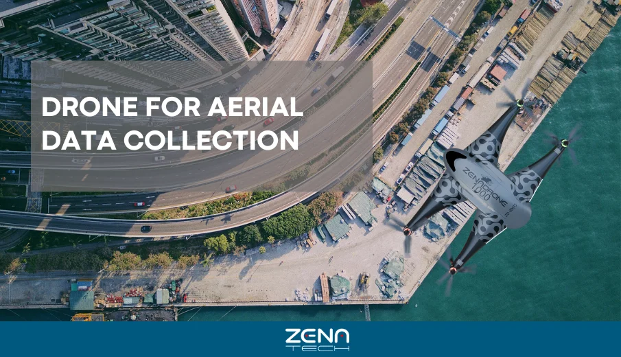
a). ZenaTech
Zenatech is a technology solution for businesses that ensures the delivery of AI-powered drone aerial collection, also specializing in Drone-as-a-Service, enterprise SaaS, and quantum computing solutions. Since 2017, Zenatech has been leading the development of its own hardware and software ecosystem through ZenaDrone, which engineers both drone platforms and aerial data analytics. The company operates globally, with a presence in North America, Europe, Taiwan, and the UAE. The mission of the company is to provide inspection, safety, compliance, monitoring, and surveying services using cutting-edge drone technology, enabling clients to collect data with precision, adaptability, and cost-effective solutions.
Zenatech integrates a wide range of technologies, such as LiDAR, thermal imaging, multispectral cameras, and AI-driven data pipelines, to meet the needs of different industries. This involves surveying, volumetric analysis, inspection, and mapping. Zenatech also serves various industries like defense, agriculture, oil & gas, mining, electrical utilities, environmental monitoring, logistics, and construction. The solutions the company offers enhance the decision-making process across industries where reliability and precision are crucial.
What sets Zenatech apart from its competitors is that the design, manufacturing, and integration of each drone, such as Zenadrone 1000 and the advanced IQ series, ensure full control over the performance and compliance. This was enhanced with AI, machine learning, and proprietary sensors, providing solutions for various industries.
For the case highlight, Zenatech plans to expand its Drone as a Service model to Dubai by 2030, leading the way in drone-powered exterior building cleaning using the AI-driven IQ Square Drone. This ensures efficiency and safety, while also addressing issues such as skyscraper density and sandstorms. The innovation of Zenatech proves that it is one of the leaders among the top drone inspection companies.
b). ZenaDrone
Founded in 2020, ZenaDrone is dedicated to helping different industries through innovative drone technology. It provides aerial photography and videography services, as well as land mapping services and inspections for construction and real estate. The company’s primary focus is on offering autonomous aerial drone surveying, customizing drone services, training services, and manufacturing.
ZenaDrone leads in providing autonomous drones equipped with AI-powered monitoring, self-driving drones, and mapping capabilities. This technology has automated flight planning, data processing, and algorithms that cater to the intelligence required, enabling industries to access aerial insights for informed decision-making.
The company highlights its aerial solutions for various industries, including agriculture, where drones can aid in monitoring crops and the environment, supporting conservation efforts, and enhancing preparedness for disasters. Inspections for construction sites are simplified with drones, which provide high-resolution imagery, automated surveys, and risk assessments, ensuring safety compliance. ZenaDrone sets itself apart from others due to its drone-in-a-box solutions, which deliver reliable, autonomous performance even in harsh environments. The notable features include automated flight planning and data processing, as well as precision tailored for various industries.
One example of the significant impact on operational delivery by ZenaDrone is when ZenaDrone’s IQ Nano Drone was tested as a prototype. This technology is equipped with proprietary Spider Vision Sensors, transforming indoor inventory and security. In a trial with electronic manufacturing partner Suntek Global, the drones enabled faster, accurate scanning of barcodes, reduced audit times, and focused on real-time visibility. This innovation proves Zenadrone’s commitment to operational efficiency and defense.
c). Drone as a Service (DaaS)
Drone as a Service (DaaS) is a drone service company that helps businesses access aerial information by delivering drone surveillance, monitoring services, and mapping. Instead of companies buying drones, they gain access to professional drone technology equipped with AI and machine learning, enabling real-time data collection that is precise and accurate.
DaaS provides drone solutions for tracking, scanning, surveillance, and inspection across various industries. The company ensures actionable data through 3D models, drone maps, and image analysis, facilitating informed decision-making and streamlining workflows.
By using DaaS, businesses can achieve cost-effective solutions, avoid maintenance, and facilitate pilot training. It will provide insights that enhance productivity, offering cost-effective, faster access, and scalability while ensuring safety and compliance. From industries like energy, construction, logistics, mining, and agriculture, DaaS empowers and helps in optimizing resources while reducing risks and providing accurate aerial data.
As Drone as a Service (DaaS) evolves, the company expects more AI-driven automation, aerial solutions that are cloud-powered, and adoption across industries, making drone technology efficient and essential for modern operations.
Top Industry Uses for Aerial Drone Data Collection
Aerial drone data collection is revolutionizing industries by providing real-time insights and precise data that help improve safety and efficiency across complex operations.
Construction & Infrastructure
Through aerial data collection, drones will monitor sites, track progress, and help identify risks as early as possible. This will help project managers reduce the delays and save costs for rework.
Agriculture
Drones equipped with sensors can provide real-time aerial data to assess crop environment health, predict risks, and optimize irrigation. It helps farmers enhance their operations and minimize resource waste.
Oil & Gas / Energy
Aerial inspections of pipelines and platforms, enhancing safety in powerlines, and reducing downtime. Drone-collected data reduces operational risks.
Mining
In mining, the aerial data collected can support the monitoring of stockpiles, volumetric analysis, and safety assessments. This allows for saving time and resources while ensuring safety.
Environmental & Surveying
Drones deliver aerial data needed for land mapping, forest monitoring, and disaster response, while supporting conservation and emergency planning. This also helps in the speed and precision of the data collected, as highlighted in our drone survey accuracy guide.
Key Trends Shaping the Future of Aerial Data Collection
As aerial drone data collection evolves with advanced technologies, key trends are shaping how it will benefit more industries in the future.
Here are some key trends as examples:
AI & Machine Learning in Drone Analytics
AI processes data faster, and for drone analytics, it requires faster image recognition, real-time insights, and predictive modeling. Industries such as construction and agriculture will benefit from improved drone analytics and accuracy in decision-making.
Autonomous and ‘Drone-in-a-Box Solutions
Drones are reliable for launch, land, recharge, and uploading data independently, and this kind of solution enables 24/7 monitoring that doesn’t require human input. Thus, it is helpful for industrial sites to collect data efficiently.
Integration with Digital Twins and GIS platforms
Various industries are now adapting to Digital Twins and GIS platforms that utilize aerial data. Using 3D models and geographic systems integrated with drone-collected data, businesses can streamline their operations and reduce risk and maintenance.
Regulatory changes and global adoption
Regulatory changes and adoption to global trends are shaping the future of drone collection through aerial monitoring. As governments prioritize safety regulations, industries can scale their drone operations by focusing on effective solutions.
Enhancing Aerial Data Collection: Technology and Equipment Insights
The technology used for aerial data collection is vital, as it is essential for practical solutions, such as drones, sensors, and processing software. Different drone types serve their own purposes and possess unique strengths.
Here is a table to understand each drone type, the standard sensors, and processing software:
| Drone Type | Best Use Cases | Common Sensors | Processing Software | Benefits |
|---|---|---|---|---|
| Quadcopters | Inspections, Construction, Security, Agriculture |
Thermal cameras Multispectral Sensors RGB cameras |
Photogrammetry tools GIS mapping |
Flexible deployment |
| Fixed-Wing Drones | Mapping large areas |
LiDAR for topography modeling Multispectral Sensors RGB Cameras |
GIS platforms for spatial analysis Photogrammetry |
Efficient coverage, high-quality mapping, Long endurance |
| VTOL (Vertical Take-Off & Landing) | Infrastructure, Energy and mixed areas |
LiDAR for terrain modelling Multi-spectral sensors Thermal cameras |
Digital Twin Platforms GIS & 3D tools (Agisoft Metashape) |
Vertical Operation and Long-Range Areas |
The integration of drones, specialized sensors, and intelligent software has enabled the collection of accurate data and transformed it into a highly accurate and efficient process.
The types of drones, like quadcopters, fixed-wing, and VTOL, paired with LiDAR, thermal, and multispectral sensors, highlight the solutions across industries.
With the help of processing platforms like GIS, photogrammetry, and digital twins, this converts the data into insights. By adopting these technologies, businesses can achieve improvements in quality and accuracy, making drone services a crucial asset for modern advancements.
Conclusion
As drone aerial data collection expands, having the right provider is the key for businesses to achieve accuracy, efficiency, and value. Whether you need the best drone services for mapping, analysis, or thermal inspections, the right partner can elevate your experience and ensure seamless, hassle-free results. Assess the best provider for your business needs and choose drone service providers with proven industry expertise, reliability, and innovations.
Here at ZenaTech, we stand out among global drone service providers, delivering innovative solutions to industries worldwide.
‘Ready to explore, soar, and achieve more? Take your operations to the next level with ZenaTech.
Explore and learn more about us at: https://www.zenatech.com
FAQS
What services do drone service providers offer for aerial data collection?
Most drone service providers offer a range of services, including land surveying, mapping, monitoring, inspection, volumetric measurements, and real-time aerial intelligence.
How do I choose the right drone service provider for my project?
When choosing the right drone service provider, ensure that you evaluate their industry experience, technology stack, safety compliance, and track record, particularly in delivering services and high-quality data.
Which industries benefit most from drone aerial data collection?
Most industries that benefit from these services are construction, mining, agriculture, oil & gas, logistics, environmental monitoring, and energy. They are the industries that require drone aerial data collection services due to the demand for accurate solutions.
What types of drones and sensors are used for aerial data collection?
Quadcopters, fixed-wing, and VTOL drones are primarily used for aerial data collection, as they are equipped with LiDAR, thermal, and multispectral sensors for capturing data.
Are drone services cost-effective compared to traditional surveying methods?
Yes! Drones are proven to deliver accurate results, reduce time and labor, also ensure safety and reduce risk for workers than traditional methods of surveying.
How accurate is aerial data collected by drones?
With AI processing and advanced sensors, drones achieve a precision of a few centimeters, often comparable to traditional surveying methods.