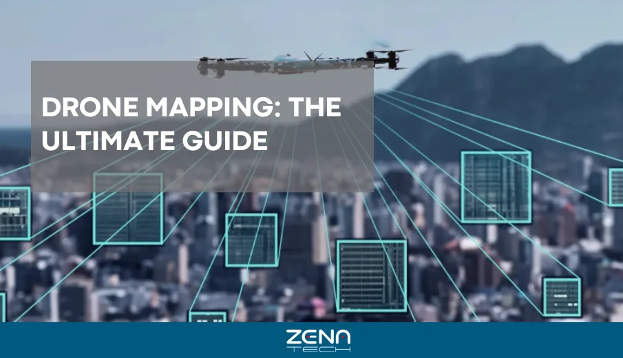
If you’ve ever seen a detailed aerial map of a construction site, farm, or even a city block and asked yourself how it got there, the odds are that drone mapping was behind it. What used to take surveyors days of measuring, climbing ladders and plumbing poles, and finally drawing can now be done in minutes with a small drone that buzzes overhead.
And here’s the thrilling thing: In 2026, drones are flying cameras no more. They’ve become autonomous data-gathering machines.
So why does this matter? Because, aside from making things faster, autonomy transforms the way industries work. It’s setting a new standard for accuracy, safety, and efficiency.
In this guide, we will tackle how drone mapping works and why autonomy is transforming the field. We’ll also explore what businesses can expect from the future of aerial surveying.
What is Drone Mapping?
Drone mapping means using drones to gather aerial data through photos, LiDAR scans, or GPS. This data is then converted into maps, 3D models, or reports.
If you sprinkle in some of that autonomous technology, drone mapping becomes exponentially more powerful. Drones can fly pre-programmed routes and adapt to conditions on the fly, They can even provide data almost instantly.
A single drone and technician can easily handle what used to take a team of experts:
- Photogrammetry: The drone captures thousands of overlapping photos, which are then stitched together to form detailed and high-resolution maps.
- LiDAR (Light Detection and Ranging): LiDAR relies on lasers to measure distances and create ultra-accurate elevation maps rather than relying on photos.
- GPS/GNSS: This guarantees that every data point is attached to the corresponding real-world location.
Key Benefits of Autonomous Drone Mapping
Speed & Efficiency
A survey that once took a week of walking the site can now be wrapped up in a single afternoon. With drones, you can even program repeat flights and surveys in advance.
Accuracy
Drones deliver centimeter-level precision, and that cuts down on human error. That level of reliability helps industries move faster and make decisions more confidently.
Safety
Instead of sending workers into hazardous zones, the drone does the risky job. Using drones means fewer accidents and more peace of mind.
Consistency
Since autonomous drones fly the same route every time, it’s easier to spot changes over days, weeks, or even months.
Cost Savings
With fewer people in the field and results coming in quicker, projects cost less overall.
Understanding Drone Mapping
How Drone Mapping Works
Picture it this way: you tell the drone what region you want a map of, and the drone makes it. From there, you can dig into the details like calculating land area, checking crop health, and evaluating a structure’s condition.
Flight Planning – We program a mission in software with parameters like boundaries, altitude, and overlap.
Uncrewed Flight – The drone can be programmed to follow a flight path and gather data continually.
Data Capture – The drone will gather overlapping images through cameras, LiDAR, or thermal sensors.
Data Processing – The software pulls everything together, stitching the images into an orthomosaic map or a complete 3D model.
Manual vs. Autonomous Mapping
- With manual mapping, the pilot must keep adjusting the drone and handling data transfers. Here, mistakes are easy to make.
- With autonomous mapping, the drone figures out the best route, flies it perfectly, and uploads the data automatically.
Real-World Applications
Drone mapping has become a must-have in industries such as:
- Construction – For cut-and-fill analysis, earthworks, and site progress tracking.
- Agriculture – They can be used to detect water stress, nutrient deficiencies, and pest outbreaks.
- Oil & Gas – Drones make checking pipelines and remote sites easier without sending big crews into the field.
- Urban Planning – They can be used to build digital twins and design smarter and more connected city models.
The Role of Autonomous Technology in Drone Mapping
AI & Machine Learning in Flight Planning
Today’s drones are highly sophisticated devices. They can dodge obstacles, save battery power, and even adjust their routes mid-flight. For operators, this is definitely good news because that means less time messing with controls and more time actually looking at the results.
Real-Time Data Processing
Gone are the days of waiting for results. Moreover, drones now process data on the edge (onboard processing) or instantly upload it to the cloud. As a result, teams can make decisions on-site.
Safety and Precision Enhancements
Autonomous drones use advanced sensors to avoid collisions, respect geofences, and adjust to wind or terrain. These onboard sensors ensure fewer risks and more reliable missions.
Cost & Efficiency Advantages
Autonomous drones may seem like a bigger upfront investment, but they quickly pay for themselves. One autonomous mapping drone can replace multiple manual surveys.
Drone Mapping Software and Tools
Hardware captures the data, but software makes sense of it.
| Flight Planning Software | Automates mission design, altitude, and image overlap. |
| Data Processing Platforms | Turn thousands of photos into accurate 2D and 3D models. |
| Cloud vs. On-Premise | Cloud tools make it easy for teams to work together from pretty much anywhere. On the other hand, on-premise setups are still the go-to if security is the primary concern. |
| GIS & Digital Twin Integration | Drone maps don’t just sit in storage; they can plug straight into GIS platforms or even into digital twin models at the city scale. |
What Are the Real-World Use Cases of Drone Mapping?
Construction
Imagine a project manager who needs to monitor progress on a massive site. Instead of climbing dirt piles and measuring by hand, an autonomous drone provides accurate progress maps every week. As a result, reports are more reliable, and clients stay informed.
Agriculture
Farmers are among the biggest winners of drone mapping. With NDVI imaging, drones detect stressed crops before the naked eye can. Which means farmers can act early, saving yields and resources.
Oil & Gas
Checking pipelines the old way is slow, costly, and dangerous. With autonomous drones, companies can scan long stretches in a fraction of the time. For instance, spotting leaks early before they turn into big problems.
Urban Planning
Planners are turning to 3D drone maps to design roads, monitor infrastructure, and guide smarter city growth. The cool part? Those maps can plug into digital twin platforms, giving cities a “living” model they can keep updating.
Leading Drone Mapping Solutions in 2026
ZenaTech
Best for AI-driven analytics, ZenaTech easily scales for large global enterprises that must quickly query massive, complex data sets in a hurry.
ZenaDrone 1000
The ZenaDrone 1000 combines fixed-wing and quadcopter versatility with autonomous flight planning and integrated mapping software.
Drone-as-a-Service (DaaS)
Not all businesses buy hardware; Drone as a Service (DaaS) offer scalable drone mapping services accessible to any company.
Challenges and Limitations
Naturally, though, drone mapping isn’t without its hurdles. The advantages may be tantalizing, but several barriers remain for both operators and companies to be aware of:
Drone Laws
Flying drones is much more than being able to power up and take surveys. The pilots must also adhere to regulations, including the F.A.A. ‘s Part 107 rules, which include everything from where drones can and cannot fly to certification requirements.
On top of that, drone regulations are continually changing, so operators must keep current with new laws.
Weather
Even though drones are advanced, they’re still at the mercy of nature. Strong winds can mess with flight stability, rain can damage the gear, and dust stormscan make it hard to see.
Bad weather sometimes makes data collection downright impossible. That’s why planning flights usually involves closely monitoring the local weather.
Data Security
The info drones pick up from a construction site, oil field, or government project can be sensitive. Keeping that data safe from leaks or hacks is a must.
Companies need solid security steps to ensure the insights they get from drone mapping aren’t in the wrong hands.
Hardware Costs
Yes, drones are cheaper now than they were a few years back, but high-end equipment like LiDAR or enterprise drones still isn’t cheap. For smaller companies, that price tag can be a genuine hurdle.
The good news? As the industry grows, costs decrease, making advanced tools more within reach.
The Future of Drone Mapping with Autonomous Technology
Drone mapping only scratches the surface of what’s possible. Looking ahead, the future is bright:
- Smarter AI – Drones will predict where to collect the most valuable data.
- 5G & Edge Computing – Faster speeds mean results delivered instantly on-site.
- Industry Expansion – Expect adoption in mining, insurance, disaster relief, and more.
- Fleet Autonomy – Imagine multiple drones working together like a team—mapping entire cities overnight.
Landing the Idea
At this point, it’s clear that drone mapping has its own way of changing how we collect and use data. And with autonomy leading the way, mapping is becoming faster, safer, and more sophisticated.
Now, look around. On farms, construction projects, pipelines, and even city planning, drones are opening up new possibilities, one flight at a time.
Our Project Features
Here at ZenaDrone, we’re proud to be part of that change. The ZenaDrone 1000 combines advanced sensors, autonomous flight paths, and AI-driven software into one platform.
There’s no more juggling of different surveying, mapping, and analysis tools because they are all in one place.
The result? More efficiency, more safety, and more accuracy. Farmers can spot crop stress early, engineers can survey land faster, and businesses can stay a step ahead.
The future of drone mapping isn’t on the horizon because it’s already here. And we’re helping lead the charge.
Friendly Asked Questions
What is drone mapping?
Using drones to capture aerial data and turn it into accurate maps or 3D models.
How does drone mapping work?
Through flight planning, aerial imaging, GPS, and processing software.
What makes autonomous drone mapping different?
Automation removes much manual piloting, resulting in faster, more accurate results.
What are the benefits of autonomous drone mapping?
Greater efficiency, lower costs, improved safety, and consistent results.
Which software is used for drone mapping?
Platforms for flight planning, data processing, and GIS integration.
What’s the difference between LiDAR and photogrammetry?
LiDAR uses lasers to measure the ground with high precision, while photogrammetry takes many overlapping photos and stitches them into detailed maps.
How accurate is drone mapping?
Drone mapping can be incredibly accurate. Under the right conditions, you can get results within just a few centimeters.
How much does drone mapping cost per hour?
On average, enterprise mapping services cost between $150–$400/hour.
How long does drone mapping take?
Typically, capture can be done in hours; processing depends on dataset size.
What’s the future of autonomous drone mapping?
Expect smarter AI, real-time processing with 5G, and fleets of autonomous drones working together.