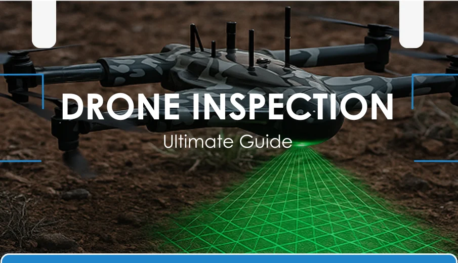
Drone inspections transform industries, providing safer, quicker, and more cost-effective solutions than traditional methods. Equipped with high-resolution cameras, thermal sensors, and AI analytics, drones deliver real-time, precise data, boosting safety and efficiency in energy, construction, and beyond.
Initially developed for military use, drones have become advanced, multi-industry inspection tools. With LiDAR, high-quality imaging, and real-time analytics, they offer detailed insights, reducing risks and downtime in sectors like oil, gas, agriculture, and infrastructure.
Drone inspections minimize human exposure to dangerous environments, lower costs, and provide accurate reporting. Selecting the appropriate drone and complying with legal regulations are essential to maximize benefits and ensure safe, lawful operations.
This article will discuss all that you should know about drone inspections. It covers their benefits, use, selection and legal regulations of their use.
What is Drone Inspection?
Drone inspection is the process of using unmanned aerial vehicles (UAVs), commonly known as drones, to examine and monitor assets or environments. These drones collect detailed data from various structures, sites, or equipment. They often replace or supplement traditional manual or ground-based inspection methods.
How Drone Inspection Works?
Drone inspections follow a structured process that ensures accurate data collection and analysis for reliable results. These inspections typically involve careful planning, advanced data gathering, and in-depth reporting to identify issues efficiently.
Planning the Mission
The inspection begins with defining the objectives, such as what assets or areas need to be inspected. Flight paths, altitude, and safety protocols are set using mission-planning software.
Data Collection
The drone flies along the planned route, capturing high-resolution images, videos, or sensor data using onboard cameras, thermal sensors, or LiDAR systems.
Data Processing
The collected data is uploaded to specialized software that analyzes the visuals and measurements. AI tools may be used to detect issues like cracks, corrosion, or temperature anomalies.
Reporting and Insights
Finally, the analyzed data is compiled into an inspection report with visuals, measurements, and identified issues. These insights help maintenance or engineering teams make quick, data-driven decisions.
Key Components of Inspection Drones
Drone inspection systems are built with specialized components that enable precise data capture and safe operation. Here are the key parts that make these drones effective:
- High-Resolution Camera: Captures clear visuals to identify cracks, rust, or other visible defects.
- Thermal Sensor: Detects heat variations to locate energy loss or overheating equipment.
- LiDAR Module: Creates accurate 3D maps for terrain and structural analysis.
- GPS & Navigation System: Ensures stable flight paths and precise positioning.
- Obstacle Avoidance Sensor: Prevents collisions by detecting nearby objects in real time.
- Data Transmission Unit: Sends live images and sensor data to operators on the ground.
- Flight Controller: Regulates drone movement, balance, and responsiveness.
- Battery System: Powers the drone and determines its flight time and range.
History and Evolution of Drone Inspection
Drone inspection has rapidly evolved from simple aerial photography to advanced, AI-powered data collection. Understanding its history highlights how far the technology has come and why it’s now vital across industries.
| Period | Development Phase | Description |
|---|---|---|
| Early 2000s | Aerial Photography Era | Drones were mainly used for capturing photos and videos in media and entertainment. |
| 2010–2014 | Commercial Adoption Begins | Affordable drones entered the market, enabling basic visual inspections in construction and energy sectors. |
| 2015–2018 | Sensor Integration | Thermal cameras, LiDAR, and GPS mapping transformed drones into professional inspection tools. |
| 2019–2021 | Automation and AI Analytics | Drones became capable of autonomous flight and AI-based defect detection, improving accuracy and speed. |
| 2022–Present | Industry-Wide Implementation | Drone inspection is now standard across oil & gas, utilities, and infrastructure for improved safety and efficiency. |
| Future | Full Autonomy and Real-Time Insights | Emerging technologies like BVLOS and edge computing will enable fully autonomous inspections with real-time monitoring. |
Types of Drone Inspections
Different types of drone inspections are used depending on the asset, environment, and data requirements. Each inspection type offers unique advantages for specific industries and applications.
| Type | Description | Common Applications |
|---|---|---|
| Visual Inspection | Uses high-resolution cameras to capture detailed imagery for detecting visible damage or wear. | Building facades, bridges, roofs, towers |
| Thermal Inspection | Employs infrared sensors to detect temperature variations and heat anomalies. | Solar panels, power lines, electrical systems |
| LiDAR / 3D Mapping | Uses laser pulses to create accurate 3D models and surface maps of assets or terrain. | Construction, mining, infrastructure |
| Multispectral Inspection | Captures data across multiple light wavelengths to assess plant health and environmental conditions. | Agriculture, forestry, environmental monitoring |
| Corrosion and Crack Detection | Detects structural defects, surface corrosion, and material degradation in assets. | Oil & gas pipelines, storage tanks, industrial facilities |
| Survey and Mapping Inspection | Captures aerial data to generate accurate maps and models for analysis and planning. | Land surveying, construction, urban planning |
Choosing the right type of drone inspection helps businesses improve safety, reduce downtime, and achieve more accurate results.
As technology advances, drone inspections continue to evolve—making large-scale assessments faster, safer, and more efficient across industries.
Advantages of Drone Inspection
Drone inspection offers numerous benefits over traditional inspection methods. It helps organizations save time, reduce costs, and improve safety while delivering precise, data-driven insights.
Here are the key benefits of drone-based inspections:
Cost-Effectiveness
The initial costs may be substantial, but drone inspections are likely to be more cost-effective in the long run. It eliminates costly resources such as scaffolding, cranes, or human-crewed aircraft.
Safety Improvements
Using drones for inspections makes workplaces safer. Drones can eliminate or significantly reduce the number of people working in hazardous environments, such as tight spaces or near dangerous objects like high-voltage equipment or buildings that are at risk of collapse.
Efficiency and Speed
A UAV can do work that would take human teams days or weeks in just a few hours. For instance, it takes a long time to walk around a big solar farm and take pictures. A drone can fly over the whole field in one flight and record real-time data.
Data Accuracy and Quality
Drones can capture pictures with a high level of detail. When used in conjunction with photogrammetry, they enable you to see details that are invisible to the naked eye. Then, AI analysis is used to find tiny flaws with great accuracy.
Environmental Benefits
Drone inspection has a significantly lower carbon footprint compared to conventional inspection methods that involve trucks, helicopters, or heavy construction machinery. Therefore, it provides a more appropriate solution to asset management.
In short, the advantages of UAV inspection are evident; it is less expensive, safer, faster, and more precise in the results, and contributes to more environmentally friendly practices.
The role of drones in inspections will only continue to expand.
What is the Drone Inspection Process?
Drone inspection is a successful process with a clearly implemented step-by-step plan rather than a random flight. The workflow will be divided into the key stages, as shown below.
| Planning the Inspection | |
| Defining objectives | Set clear goals such as detecting cracks, monitoring corrosion, or measuring heat loss. Objectives guide the choice of sensors and mission parameters. |
| Flight path planning | Design flight routes that maximize coverage and maintain safe separation from obstacles. Accurate paths improve consistency and reduce risks. |
| Regulatory approvals | Comply with aviation authority rules such as altitude limits or licensed pilot requirements. Meeting legal standards safeguards operations and builds trust. |
| Equipment Setup | |
| Drone selection | Pick rotary-wing, fixed-wing, or hybrid drones depending on agility, range, and mission efficiency. Each platform offers different benefits. |
| Sensor & payload setup | Install cameras, thermal imagers, or LiDAR sensors as required. Correct setup ensures quality and analysis-ready inspection data. |
| Execution Phase | |
| Autonomous vs manual flights | Automated missions improve repeatability, while manual control allows adaptive responses during complex inspections. |
| Data capture techniques | Gather images, video, and sensor readings with planned overlap and triggers for accuracy and consistent datasets. |
| Post-Processing and Data Analysis | |
| Image & video analysis | Experts review imagery to detect anomalies or defects. Findings guide maintenance priorities and corrective actions. |
| AI & machine learning applications | Use advanced software to identify patterns, compare with benchmarks, and highlight issues. AI reduces errors and accelerates insights. |
| Report generation & decision making | Convert inspection data into actionable insights with 3D models, trend analysis, and annotated images. Reports support planning, resource allocation, and safety improvements. |
This information helps asset managers and engineers prioritize repairs and allocate maintenance budgets more effectively.
By leveraging drone inspection data, they can make confident, data-driven decisions to maintain critical infrastructure in optimal condition and prevent costly failures.
What’s the Best Drone for Inspections?
Choosing the right platform for drone inspection is based on reliability, flexibility, and the quality of the data. As technology advances at a high rate, organizations are in search of UAVs that can meet high demanding conditions, and provide accurate outcomes.
Among the top drone models in 2025, the ZenaDrone 1000 stands out for its robust design, advanced sensors, and autonomous capabilities. Engineered for precision and efficiency, it excels in industrial inspections across sectors such as agriculture, energy, and infrastructure—reducing operational time, cutting costs, and enhancing worker safety.
| Feature | ZenaDrone 1000 | ZenaDrone IQ Nano | ZenaDrone IQ Square |
| Primary Focus | Enterprise-level UAV for industrial inspections and large-scale operations. | Compact inspection drone ideal for confined spaces and close-range analysis. | Mid-sized drone built for high-precision mapping, surveying, and monitoring. |
| AI & Automation | Advanced AI with autonomous flight planning, predictive maintenance, and real-time analytics. | AI-assisted obstacle avoidance and adaptive positioning for detailed inspections. | Smart automation for grid-based missions and data synchronization with cloud tools. |
| Sensor Support | Multisensor payloads including LiDAR, RGB, thermal, and multispectral sensors. | High-resolution RGB and thermal cameras optimized for interior or structure scanning. | Supports modular payloads for 3D mapping, NDVI, and environmental monitoring. |
| Scalability | Fully enterprise-scalable with IoT connectivity and digital twin integration. | Best for small to medium operations requiring portability and quick deployment. | Adaptable for both enterprise and commercial projects, offering flexible mission scaling. |
| Durability | Rugged carbon-fiber frame designed for extreme weather and industrial environments. | Lightweight yet durable body suitable for both indoor and outdoor inspections. | Reinforced construction with weather resistance and stable performance in variable conditions. |
| Industry Integration | Ideal for energy, agriculture, infrastructure, and public safety industries. | Perfect for building inspection, facility management, and manufacturing assessments. | Engineered for surveying, mining, utilities, and environmental monitoring. |
Drone Inspection Applications Across Industries
Drone inspections are universal and widely used across various sectors. In producing energy, emergency response, and management, drones transform how organizations utilize assets, protect people, and make informed decisions.
Energy and Utilities Drones
Drones provide more precise and practical information to protect critical energy infrastructure.
Power Line Inspections
A UAV inspection can survey power lines in seconds to inspect faults, vegetation intrusion, or damage following storms. It reduces downtime and avoids the costly consequences that result from downtime.
Solar Panel Monitoring
Thermal drones detect unproductive or overheated panels and repair them promptly, resulting in an immediate improvement in efficiency.
Wind Turbine Assessments
Drones are used to capture close-up shots of hazardous areas on the blades without the need for a rope or crane.
Drones in Oil & Gas Industry
Drones minimize risk and guarantee regulatory compliance in some of the most hazardous environments. Here is the Inspection type and focus for the oil and gas industry.
Pipeline Monitoring
Drones are used to survey long pipelines to ensure they are not leaking, corroding, or encroaching on surrounding areas. UAVs also enhance adherence to environmental policies.
Offshore Rig Inspections
Drones will minimize unsafe manual inspections in offshore settings—a UAV inspection results in high-quality visuals that prevent production stagnation and potential worker injury.
Drones in Construction and Infrastructure
Drones offer a safer and more effective method for assessing high-rise buildings, aiding in the long-term management of assets. Here is the Inspection type and focus for the construction and infrastructure industry.
Building Inspections
A drone survey may reveal structural defects, including cracks, water erosion, and material wear on roofs and the exterior.
Bridge and Tunnel Assessments
UAVs can reach inaccessible places and capture detailed images without the need for scaffolding or road blockages. These insights help ensure the long-term safety of infrastructure.
Drones in Mining Industry
Drones enhance safety and efficiency within one of the most hazardous workplaces.
Stockpile Measurement
UAVs can provide precise volumetric information about stockpiles, thereby enhancing the inventory management system and reducing the risk of errors associated with manual surveying.
Safety Inspections in Mines
Drone inspection can be used to survey hazardous regions of a mine or an unstable landscape, reducing the risks to which workers are exposed.
Public Safety and Emergency Response
Drones play a crucial role in this industry, assisting in life-saving decisions when every second counts.
Search and Rescue
Thermal camera drones can quickly locate the missing person. Even in low-visibility environments, drones can detect objects more rapidly and safely.
Disaster Assessment
UAV inspection provides a clear picture following earthquakes, floods, or fires. Authorities can channel efforts and resources to where they are most needed.
Legal and Regulatory Considerations for Drone Inspections
Although drone inspection has numerous advantages, companies should also consider the law. Compliance with rules ensures the safety of activities and maintains privacy, thereby minimizing legal liability.Global Regulatory Framework
Part 107 of the Federal Aviation Administration (FAA), regulates commercial activity of UAVs in the United States. This framework establishes limits to the altitude of flight, licensing of pilots, and airspace limits. In Europe, the European Union Aviation Safety Agency (EASA) offers comparable guidelines, and it guarantees uniformity in safety practices among the member states. In order to conduct the UAV inspection operations, other countries have their own aviation laws, yet they all focus on risk management and accountability.Certification and Licensing
In most regions, drone operators are required to hold certifications or licenses. Training enables pilots to navigate various environments and respond effectively to emergencies safely. Additionally, UAVs are typically required to be registered by local authorities, making the operator responsible for compliance.Privacy and Data Security
Companies must adhere to data protection laws, as drone inspections are used to collect visual and sensor-sensitive information. The General Data Protection Regulation (GDPR) in the European Union (GDPR) requires stringent personal or sensitive data protection. Ethical data management fosters trust among clients and the broader public.Insurance and Liability
Drones used in commercial inspections are commonly subject to specialized insurance. The coverage can be related to damage to equipment, third-party liability, or operating risks associated with being close to critical infrastructure. Observing best standards and practices helps companies ensure safe, compliant, and credible UAV inspections. While insurance covers businesses and customers, pilots minimize damage through risk mitigation strategies like pre-flight checks. For readers interested in an industry analysis on drone service platforms, examining how UAV technologies fit into global service ecosystems can provide valuable context for strategic planning.Future of Drone Inspections
Various factors drive the rapid growth and adoption of drone inspections worldwide, ranging from automation to artificial intelligence and connectivity. As more industries continue to digitize, drone inspections will become more precise and affordable.Role of AI and Automation
Drones are becoming smarter over time. Machine learning helps them find problems, sort through changes, and plan maintenance. It saves human time in interpreting data and gives fast and accurate results. Cases of fully autonomous UAV missions are also being developed, where generative AI implementation enables the drone to plan routes, gather data, and analyze findings with minimal human involvement.Integration with IoT and Digital Twins
Among the essential innovations, drone inspection data, digital twins, and IoT can be included. By feeding real-time information into digital copies of assets, organizations can track their performance in real-time and simulate different conditions. This strategy enhances proactive decisions and increases the life cycle of assets.Emerging Trends for 2030
As drone technology has evolved, various sectors, including smart cities and environmental protection, are adopting the concept of drone inspection. UAVs provide significantly more information than the existing approaches because they possess better sensors, such as hyperspectral imaging and LiDAR. ZenaTech is the first company to introduce this change, developing innovations to make UAV inspection smarter, safer, and more sustainable. We respond to today’s changes by embracing emerging technology and evolving our organization to suit future inspection needs. We are not only responding to the current challenges by embracing emerging technologies, but also shaping our organizations to meet the inspection needs of the future.Drone Inspections Takeaway
Drone inspection development has transformed how industries approach safety, efficiency, and asset management. In energy, infrastructure, agriculture, and public safety, drone inspections provide practical information with minimal risk and cost. UAV inspections, combined with advanced AI, automation, and coordination via the Internet of Things, enable companies to develop more innovative and productive solutions. ZenaTech is the pioneer in the drone revolution. The ZenaDrone 1000 is our flagship product, offering you numerous benefits. It features a cutting-edge sensor display, AI-driven analytics, and a robust design. Ready to open the door of the future of inspections? Collaborate with Zenatech now and find out how customized UAV packages can bring your operations to a new level.Friendly Asked Questions
What are the main benefits of drone inspections?
Drone inspection is a safe and efficient method for inspecting assets, buildings, or the environment using UAVs equipped with cameras or sensors.
How much does a professional inspection drone cost?
A professional inspection drone can cost anywhere from $10,000 to $50,000, depending on the sensors, payloads, and other features it has.
Are drone inspections legal everywhere?
Most countries permit drone inspections, but they must adhere to the specific rules governing flight operations in their respective areas.
Are any commercial drone inspection licences required?
Most countries require a license or certification for business use. You should follow the rules of your local air agency, as they may differ.
What is the way Zenatech can help me with my inspection requirements?
Zenatech highly developed UAV platforms and inspection solutions that suit various industries and are accurate, safe, and in line with the changing regulations.