When a drone can fly beyond the line of sight, it can do a lot more things. Drones that fly BVLOS can go much farther than a pilot can see with their own eyes.
This makes it possible to do things like surveying, inspecting, and delivering things over long distances in dangerous or hard-to-reach places. These operations keep people on the ground, which saves time and money and makes things safer. But they also need strict rules and advanced technology to work.
This guide will tell you what BVLOS means, how BVLOS drone systems work, the rules that govern them, and the main pros and cons. We also talk about how BVLOS is used now and in the future, how to get certified, the best drone platforms, and how businesses can get ready for this new technology.
What is BVLOS in Drone Operations?
BVLOS (Beyond Visual Line of Sight) means flying drones beyond the pilot’s direct vision. It relies on advanced sensors and communication systems to maintain control. This capability allows longer missions without constant visual contact. BVLOS expands applications in delivery, inspection, and surveillance while following strict regulations.
In real life:
- VLOS: The pilot and the UAV can see each other directly (usually less than 500 m). Easy checks and taking pictures.
- EVLOS: One or more observers extend the range, for example, flying out of sight in one direction while spotters keep an eye on the plane from other points.
- BVLOS: The drone flies out of sight of everyone and uses its own systems, like GPS, communications, and sensors, to find its way and avoid things in its way.
BVLOS is important for industries that need automated flights over long distances. Drones can only fly BVLOS to do things like check on power lines and pipelines, survey big areas, and deliver packages over long distances.
By allowing BVLOS, missions that go “beyond the horizon” can be done, so inspection fleets can cover miles of infrastructure without having to send people everywhere.
How Drone BVLOS Operations Work
A number of advanced systems must work together for BVLOS flights to work:
Drones use high-precision GPS/GNSS
Usually with (RTK/PPK) to follow pre-programmed waypoints over long distances. This keeps the UAV on its planned path, even when no one can see it.
Command and Control Links
A strong communication link (C2) keeps the drone and pilot in touch with each other at all times. 4G and 5G cellular, satellite (SATCOM), and licensed RF radios are some of the most common channels. These links send live telemetry and video feeds, and you can turn them off by hand if you need to.
Systems for Detecting and Avoiding (DAA)
DAA stands for “Detecting and Avoiding.” BVLOS drones need to be able to find and avoid obstacles on their own because pilots can’t see them.
Today’s BVLOS UAVs have a lot of sensors. These sensors help them find and avoid other drones, planes with people on board, birds, power lines, and other things. Some of these sensors are radar, LiDAR, optical and infrared cameras, and ADS-B receivers. The software on board can change course on its own if it sees a chance of a crash.
Ground Control and Monitoring
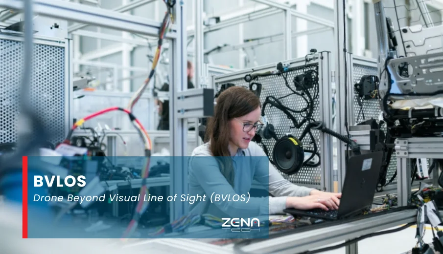
Operators use ground control software to keep an eye on the flight. A typical Ground Control Station (GCS) shows live maps, videos, and information about flights.
As you can see below, pilots use a laptop or tablet to see information in real time and make plans for the flight. If something goes wrong, like losing a link, fail-safe protocols like return-to-home and auto-landing kick in.
Remote ID tells the drone who it is, and UAS Traffic Management (UTM) tools help it stay away from restricted areas. For BVLOS operations to be legal in the US, this must be integrated into the airspace with ADS-B/EC and Remote ID.
In real life, a BVLOS flight works from start to finish: planning the route before the flight, ensuring a stable connection, navigating automatically, avoiding other aircraft, and monitoring everything from a single location. Cloud-based systems can even control multiple drones at once, allowing one control centre to manage an entire fleet across an area.
Regulations and Legal Requirements for BVLOS
United States (FAA BVLOS Rules)
- You need a waiver or permission to fly BVLOS.
- At least a Part 107 certificate is required for pilots.
- Every mission needs to file a flight plan that includes information about the area, how to communicate, and safety.
- Most of the time, waivers depend on detect-and-avoid (DAA) technology.
- Parts 108 and 146 of the FAA’s new rules are meant to replace waivers with structured certifications.
Europe (EASA)
- BVLOS is in the “Specific” category.
- Operators must do a SORA risk assessment and get approval.
- Drones need sensors and reliable communication.
- Pilots require a special license.
Canada & Others
- Canada’s TP 15263 also requires permits and training.
- Other regions follow similar rules with risk checks and permissions.
Pilot Qualifications
- U.S. pilots pass the Part 107 exam.
- Draft Part 108 rules may add new trained roles like Operations Supervisor.
- Worldwide, BVLOS training is becoming a standard requirement.
In short, BVLOS means more paperwork, approvals, and training than casual drone flights, but these steps ensure safe integration of unmanned flights beyond visual range.
End-to-End Inspection Capabilities with BVLOS
One of the best advantages of BVLOS is long-distance continuous inspection. Drones can fly along power lines, railways, fences, and pipelines without stopping. For example, oil and gas companies now use BVLOS UAVs to patrol pipelines. A single mission can cover tens of miles, using high-resolution and thermal cameras to detect leaks, corrosion, or security breaches.
Utilities also rely on BVLOS flights along transmission lines to spot issues like vegetation growing too close to the lines or damaged towers. This approach eliminates the need to send technicians on foot, improving safety and operational efficiency.
The advantages are clear:
Continuous Coverage
A BVLOS drone can keep an eye on an entire corridor, like a pipeline that is 50 kilometres long or more, in one mission. It sends real-time video and sensor data to a central command centre, which lets them find problems right away (like leaks, hot spots, bird nests, etc.).
Cost Savings
Helicopters or ground crews are often used for traditional inspections, which take a long time and cost a lot of money. Research shows that BVLOS drone programs can save a lot of money on inspections. For example, one report says that the cost of collecting BVLOS data dropped by about 46% compared to older methods that used visual observers.
A 2023 UAV survey found that inspecting power lines with drones usually costs between $300 and $2,000 per mile. BVLOS greatly extends the range of each flight, which lowers the cost per mile.
Safety
Drones keep people from going to places that are dangerous. You don’t have to send workers near high-voltage lines or fly helicopters over rough ground. Most of the time, operators stay in an office while the drone is flying.
High-Quality Data
BVLOS drones can collect more information than manned cursory surveys because they have thermal, LiDAR, and high-definition cameras. More flights mean that problems are found sooner, which stops failures.
24/7 Operations
BVLOS lets one pilot (or automated system) run multiple drones, so they can be watched all the time. Drones can take off at night or in bad weather (as long as they follow the rules), which lets them keep an eye on things all the time.
As one industry note puts it, BVLOS platforms let you “monitor 24/7 – … track and inspect all the time” without having to have a person at each site.
Manned inspections, on the other hand, need more people and cost money to keep helicopters running and fueled. Long-term infrastructure benefits from BVLOS drone programs because they cut down on labour costs and speed up the process.
The end-to-end benefit is that the inspection process is safer, has more data, and costs less than any other manned approach.
Benefits of Drone BVLOS
There are a lot of good things about BVLOS operations:
Feature | Details |
Longer Range | Drones can fly for tens of kilometres at a time, which is much longer than the 500 m (or so) limit of VLOS. This means that one car can cover a lot of ground. The ZenaDrone 1000, for instance, can fly up to about 100 km on one battery. Long range is important for linear inspections or mapping tasks from a distance. |
Increased Safety | People are less likely to be in dangerous places (like wildfires or contaminated sites) when there is no human pilot in the area. You can see dangerous places (like flare stacks and storm damage) without putting anyone in danger with BVLOS. |
Efficiency and Productivity | Over time, BVLOS fleets lower the costs of labour and logistics. You don’t have to move pilots or keep helicopters in good shape for each mission. Also, as was said before, BVLOS implementations can cut the cost of each inspection by 40–50%. |
Operational Cost Savings | Over the long run, BVLOS fleets reduce labor and logistics costs. No need to shuttle pilots or maintain helis for each mission. Plus, as noted earlier, the cost per inspection can drop 40–50% with BVLOS implementations. |
Regulatory Alignment | New BVLOS drones come with built-in features like ADS-B, Remote ID, and lighting that make it easier to follow the rules and fly legally. |
In general, BVLOS turns drones from toys that can only fly short distances into business-grade aircraft that can be used for inspections and deliveries over large areas.
Challenges of BVLOS Operations
BVLOS is not without hurdles. Key challenges include:
Technical Complexity
The high-tech gear, such as DAA sensors, dual data links, and precision navigation, makes things harder. It’s very important to make sure that long-distance communication is reliable and doesn’t have a lot of lag. A signal lag of even a few seconds can be dangerous. Experts say that for safety, command latency should be less than 500 ms. It’s important to plan your network well because links at high altitudes or from satellites can slow things down.
Safety and Reliability
Even with DAA, flying without a line-of-sight safety net means extra risk. Systems must be redundantly robust. BVLOS drones must safely integrate with manned traffic; without effective ADS-B or radar integration, regulators will not approve a flight.
Regulatory Burden
The approval process for BVLOS can be slow and stringent. Every route and scenario often needs a case-by-case review. Operators must demonstrate thorough risk mitigation (e.g., geofencing, lost-link protocols, insurance) before getting permission.
Training and Operational Costs
Specialized pilot training programs, simulator or real-world BVLOS exercises, and expensive sensor packages raise the barrier to entry. Even though operational costs are lower long-term, the upfront investment in aircraft and staff training is significant.
Public and Environmental Concerns
Flying beyond sight can attract public scrutiny (privacy, noise) and environmental impact questions. Companies must address community concerns and ensure wildlife is not disturbed.
Many of these challenges are being addressed as technology and rules evolve. Still, BVLOS flights require rigorous pre-flight planning, backup systems, and experienced teams to mitigate the inherent complexities.
Drone BVLOS Applications Onward
By 2025, BVLOS drones will have proven valuable across multiple domains:
Utility Inspections
Powerline, pipeline, and telecom corridor patrols are classic BVLOS missions. Drones scan hundreds of miles of grid infrastructure for corrosion, vegetation, or damage, sending data back in real time.
Agriculture and forestry
Farmers use BVLOS UAVs to keep an eye on large areas of crops or forests. Fixed-wing drones make maps of land to check on plant health and growth, and they spray fields with dust crops. In forestry, BVLOS flights check the health of trees and the risk of wildfires over large areas of woods.
Search and Rescue
BVLOS drones are used by emergency teams to find hikers who have gone missing or disaster survivors in hard-to-reach places. Using thermal cameras and live feeds, one drone can quickly search an area that would take ground crews hours to cover.
Infrastructure Monitoring
Bridges, dams, and railways are examples of critical infrastructure that can cover a lot of ground. BVLOS drones fly over buildings and other structures on a regular basis to look for problems or encroachment. For instance, checking hundreds of bridges along a river with one mission saves a lot of work.
Environmental Monitoring
Drones check on the health of forests, oil spills, wildlife populations, and water quality. A BVLOS platform can keep an eye on herds of animals moving from one place to another or keep an eye on erosion along miles of coastline. The JOUAV CW-15 drone, for example, is a quick-response BVLOS asset that is used to keep an eye on wildfires.
Delivery and Logistics
Companies are still testing BVLOS drones for package delivery and medical supplies, especially in hard-to-reach places like islands or remote villages where ground transportation is slow.
In short, BVLOS is a great choice for any use case that needs to cover a lot of ground, respond quickly, or keep an eye on something all the time. The common thread is that it makes drones useful in places that people can’t see or get to.
How to Get BVLOS Certified
Getting approved for BVLOS typically involves several steps:
Getting a Pilot’s License
To become a BVLOS operator in the U.S., you must first pass the Part 107 (Unmanned Aircraft General) knowledge test to get an FAA Remote Pilot Certificate. In other countries, you need a drone pilot license or a training course that is the same as this one.
Many companies now offer specialized BVLOS training programs
These include BVLOS rules, planning flights, emergency procedures, and hands-on simulations. For example, some training programs include practicing how to detect and avoid problems and how to manage airspace.
Approval of equipment
Make sure your drone has all the safety features it needs, like ADS-B In/Out, Remote ID, anti-collision lights, and parachute recovery (if needed). Some regulators say that a drone must be on an approved UAS list or have a certified standard. For example, Part 108 in the U.S. will list drones that meet these standards.
Request for a Waiver or Permit
Make the BVLOS authorization package and send it to the aviation authority. This includes detailed flight profiles, risk-reducing steps (like range testing results and DAA performance), and plans for how to talk to each other. In the U.S., this is the FAA waiver or Part 91 operational approval. In Europe, it’s the Specific Operations Risk Assessment (SORA) dossier for an Operational Authorization.
Review and Iteration
Authorities may request clarifications or additional data. This review can take weeks to months. It’s common to conduct trial flights under VLOS or EVLOS to gather data for the application.
Certification and Costs
The timeline and cost vary. Budget several thousand dollars in engineering, training, and application fees. Expect 3–6 months to get fully certified, depending on complexity. Some commercial trainers bundle exam prep and waiver support to speed this up.
In sum, BVLOS certification is a multi-stage process of education, paperwork, and technology readiness. Demonstrating safety is paramount; gaining experience through EVLOS flights and building a strong safety case greatly improves approval chances.
Best Drones for BVLOS on the Market [2025 Update]
Modern BVLOS missions call for specialized UAVs. Below is a snapshot comparison of notable platforms (as of 2025):
| Model | Range | Flight Time | Payload Capacity | Sensors / Notes | Approx. Price |
|---|---|---|---|---|---|
| ZenaDrone 1000 | ≈30–50 km (typical) | ~40 min¹ | ~40 kg (heavy-lift) | AI-enabled VTOL; multi-sensor; heavy cargo capable | – |
| ZenaDrone IQ Nano | ~0.5 km (indoor) | 20–25 min | ~0.5 kg (small) | Indoor drone with HD/thermal camera, LiDAR | – |
| ZenaDrone IQ Square | ~15 km (estimate) | ~40 min (estimate) | ~1 kg | Outdoor small drone for surveys; HD camera, LiDAR | – |
ZenaDrone platforms (1000, IQ Nano, and IQ Square) exemplify Zenatech’s emphasis on AI autonomy and rugged design. The Trinity F90+ is a workhorse for mapping with its long wings and precision geotagging. DJI’s Matrice 350 RTK is a versatile multi-rotor with a strong link range and RTK accuracy.
There are good and bad things about each model. The ZenaDrone 1000, for instance, has a hybrid design that allows it to lift heavy loads and last longer, but it is more complicated. The Trinity can fly longer because it is more efficient, but it needs room to take off and land. The DJI M350 is very reliable and has a lot of support (with different camera options), but it can only go about 20 km.
The small IQ Nano is great for surveys inside or up close, and the IQ Square is great for inspections outside. When choosing a BVLOS UAV, users should think about the range, payload, and type of platform.
How to Choose the Right BVLOS Drone
When choosing a BVLOS-capable UAV, you need to think about the mission, the technology, and the cost:
Regulatory Compliance
Ensure the drone meets all legal requirements. For example, it should support the region’s Remote ID system and ideally have ADS-B In to detect nearby manned aircraft. Anti-collision lighting and parachute systems may also be mandated.
Communications
Choose a system with redundant C2 links. External antennas, dual-band radios, or 4G/5G modules improve reliability. Test that command latency stays low (<500 ms) under expected conditions.
Sensors and Safety
The UAV should have enough DAA sensors (radar, LiDAR, cameras) for the airspace it will be flying in. The Ground Control Station needs to show telemetry and alerts in real time so that operators can respond quickly.
Range & Endurance
The base flight time and range depend on the length of your route and the weight you need to carry. Multirotors (like the DJI M350) are better at moving around, while fixed-wing hybrids (like the Trinity or ZenaDrone 1000) can fly for longer.
Payload & Equipment
Make sure the payload capacity matches the sensors you need, like a high-res camera, thermal imager, LIDAR, etc. Don’t put too much weight on the UAV; it still needs to work well.
Cost vs ROI
When comparing costs and returns on investment (ROI), don’t just look at the cost of the aircraft; also look at how much money it will save you to operate it. A long-range drone that costs more might save money by replacing several shorter flights or inspections done by people. Think about the costs of training, maintenance, and batteries.
Industry Needs
Different industries have different needs. Agricultural drones may focus on multispectral cameras and ease of use, while utility drones need strong communications and protection from icing when working on power lines.
Future-Proofing
To ensure your system is ready for the future, look for modular systems that can upgrade sensors and software and that support advanced autonomy or swarm management (getting ready for UTM environments).
In summary, list your mission requirements and vet drones against them. A drone that checks all regulatory boxes and has proven BVLOS experience (e.g., prior waivers or certifications) is often worth the investment for enterprise operations. Remember to leverage internal expertise or consult experienced providers to guide the selection.
Future of BVLOS Drone Technology
The future of BVLOS depends on improvements in airspace management and autonomy:
AI-Driven Navigation
Drones will have more machine learning to avoid obstacles and fly in a dynamic way. AI can help drones deal with bad weather or other problems that come up without needing help from people.
Unmanned Traffic Management (UTM)
The FAA and other authorities are developing UTM systems and Automated Data Service Providers (ADSPs) to coordinate many BVLOS flights. These cloud-based networks will let drones share airspace, file flight plans digitally, and get real-time traffic alerts.
Fully Autonomous Swarms
BVLOS operations will grow more automated. One operator could dispatch a fleet of drones that self-organize and cover area-wide missions, relying on onboard autonomy for routing and collision avoidance.
Integration with IoT and Smart Infrastructure
BVLOS drones will work with Internet of Things networks. For instance, they could get signals from sensor grids (like sensors that detect leaks in pipelines) or send data to smart-grid management systems.
Extended Endurance Platforms
New technologies like hybrid propulsion, high-density batteries, and even solar power (as seen in test flights in 2025) will make BVLOS missions last even longer.
Improved Safety Technology
BVLOS will likely approve new standardized DAA technologies in the next few years. These could include on-board radar packages and built-in algorithms for avoiding collisions. This will make it easier to get approval.
In short, BVLOS will become a more common part of commercial aviation. Rules are changing to make it possible, and technology is changing to meet the need. Companies that keep up with these trends will be able to get the most out of their drone operations.
Conclusion
Drones work differently when they fly BVLOS. It gets rid of the “line of sight” barrier, making it easier, safer, and cheaper than ever for businesses to check on, survey, and keep an eye on their assets. As rules change (like FAA’s Part 108 and EASA’s Specific Category) and technology gets better (like AI navigation and UTM), BVLOS will go from being a test to a normal way of doing things.
Companies that want to stay ahead of this change should start getting ready now by training pilots, getting better equipment, and making BVLOS a part of their long-term plans.
You might want to work with providers who have been around for a while if you want to use BVLOS safely and well. The ZenaDrone line from Zenatech is a great way for businesses to get BVLOS capabilities. The ZenaDrone 1000 is a VTOL UAV that can fly on its own and carry heavy loads over long distances. It also has smart sensors that use artificial intelligence.
The small IQ Nano is great for looking closely at things inside and outside. It can avoid things in its way and take pictures that are very clear. These drones, along with our secure cloud-based control and communication systems, give businesses the range, reliability, and performance they need today.