Drones have moved from hobbyist gadgets to workhorses of modern industry. In warehouses, construction sites, farms, and even oil refineries, flying robots now inspect equipment, count inventory, and deliver parcels.
One of the technologies making these missions possible is obstacle avoidance—an electronic “sixth sense” that stops a drone from hitting walls, trees, or utility poles. Without it, drones could easily collide with objects, endangering people and destroying expensive hardware.
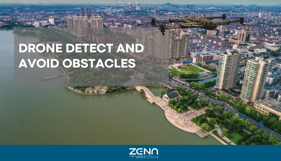
In this article, we explore how drones detect and avoid obstacles, the sensors and algorithms involved, and why this capability is essential for everything from indoor inventory counts to search-and-rescue operations.
What Is Obstacle Avoidance in Drones?
Obstacle avoidance is the ability of a drone to sense objects in its path and steer clear of them. Instead of relying solely on a pilot’s line of sight, an obstacle‑aware drone uses sensors to perceive its surroundings.
When an object appears within a defined buffer distance, the flight control system either stops, reroutes, or hovers until it is safe to continue. This differs from manual flying, where the pilot must judge distances and react quickly; autonomous detection allows the drone to operate safely even when the pilot cannot see hidden hazards.
For example, a delivery drone navigating between skyscrapers uses LiDAR and stereo cameras to map surfaces, while a quadcopter inspecting wind turbines uses ultrasonic sensors to maintain a safe stand-off distance from blades.
Why Obstacle Avoidance Matters
Flying into an obstacle can damage propellers, cameras, or payloads and cause serious injury to bystanders. ZenaTech inspection report notes that indoor drones allow inspectors to collect visual data remotely instead of entering confined oil-and-gas assets; this reduces exposure to combustible gas, working at height, and other hazards.
Similarly, search-and-rescue (SAR) experts highlight that missions often take place in dense forests or collapsed buildings where unexpected obstacles can appear. Obstacle avoidance is therefore critical to protect both the drone and the people relying on it.
Beyond safety, obstacle avoidance improves mission success. Autonomous drones can map large areas, deliver packages, or scan crops without constant human intervention. It also helps by:
- Enhancing safety operations
- Increasing flight efficiency
- Reducing maintenance costs
This intelligent flight behavior conserves battery power by avoiding sudden stops and propeller strikes, increasing flight time, and preserving expensive sensors and cameras.
Where Drone Obstacle Avoidance Is Used
Indoor Applications
Warehousing & Inventory Management
Autonomous warehouse drones scan barcodes and RFID tags on shelves, navigate narrow aisles, and take photos of high racks using LiDAR, vision navigation, and simultaneous localization and mapping (SLAM). According to a 2025 supply-chain automation report, these drones reduce labor costs, perform inventory counts quickly, and improve worker safety while sharing real-time data with warehouse management systems.
Because warehouse facilities often have steel racks, forklifts, and workers, obstacle avoidance keeps drones from colliding with infrastructure or people, ensuring uninterrupted and safe operations.
Factories & Industrial Plants
In manufacturing facilities, drones inspect pipelines, boilers, and conduits. They must weave through machinery and narrow passages; LiDAR or ultrasonic sensors maintain safe distances, and protective cages allow contact with surfaces without damaging rotors.
These systems enable inspections of chimneys, smokestacks, and storage reservoirs in the oil and gas sector, where confined spaces and combustible gases make human entry hazardous. Key functions include:
- Safe confined inspections
- Reduced human risk
Indoor Inspections
Indoor drones provide visual data and ultrasonic thickness measurements within assets such as offshore rigs, jetties, and storage tanks. They reduce downtime because inspectors can stand safely outside while the drone collects data. SLAM algorithms create 3‑D models of vessels, enabling engineers to locate faults and plan maintenance without manual scaffolding or rope access.
Research & Education
Universities and robotics laboratories use indoor drones to test new sensors and navigation algorithms. Controlled environments enable researchers to evaluate stereo vision depth perception or infrared detection under varied lighting conditions and refine path-planning methods.
Outdoor Applications
| Application | Key Technologies Used | Main Benefits |
|---|---|---|
| Delivery Drones | GPS, Machine Learning, AI, Computer Vision, LiDAR, Ultrasonic Sensors, Barometric Sensors, Infrared/Thermal Cameras | Safely navigate urban areas, avoid obstacles, deliver goods in low light or bad weather |
| Agriculture | LiDAR, Multispectral & Hyperspectral Imaging, Thermal Cameras | Prevent crop damage, detect plant stress, reduce chemical use, improve precision farming |
| Construction & Mining | LiDAR, 3D Mapping, BIM Integration | Capture precise terrain data, avoid collisions with machinery, enhance planning and monitoring |
| Public Safety & Search and Rescue | LiDAR, Ultrasonic, Stereo-Vision, Infrared Sensors | Navigate disaster zones safely, extend flight time, protect rescuers and victims |
| Oil & Gas / Energy Inspections | LiDAR, Ultrasonic Sensors, Protective Cage (Elios 3) | Enable confined-space inspections, reduce worker risk, maintain safety and data quality |
How Drones Detect Obstacles?
Effective obstacle avoidance begins with sensing. Drones employ a mix of active and passive sensors to perceive their surroundings, each with strengths and limitations.
Ultrasonic Sensors
Ultrasonic sensors emit high-frequency sound waves (typically 25–50 kHz) and measure the time it takes for echoes to return. They calculate distance based on this time of flight and are often used on small drones for low-altitude collision avoidance.
Ultrasonic sensors are inexpensive and unaffected by object transparency—glass or plastic does not confuse them—but they can be inaccurate if the sound is absorbed or reflects away at odd angles. Because sound waves travel slowly compared with light, their effective range is limited, but they are ideal for near-field detection, such as hovering near walls or landing on platforms.
Infrared Sensors
Infrared (IR) proximity sensors emit pulses of IR light and measure the reflection to detect objects. They are inexpensive and useful for detecting obstacles within a few meters, particularly in low-light conditions.
However, IR sensors are sensitive to ambient lighting and temperature; sunlight or heat sources can cause false readings, and thermal images have lower resolution, which requires additional image processing.
IR cameras are often paired with RGB cameras or LiDAR to compensate for these limitations.
Stereo Vision Cameras
Stereo vision systems utilize at least two or more cameras mounted at known distances apart. By comparing the disparity between the two images, the system calculates depth and builds a 3-D map. Stereo cameras are compact and provide absolute depth estimates, making them popular on small drones.
However, they require significant processing power and rely on good lighting and textured surfaces. Performance degrades in uniform or low-light environments. Key advantages include:
- Accurate depth perception
- Compact and lightweight design
Newer designs combine stereo cameras with inertial measurement units (IMUs) to improve robustness.
LiDAR (Light Detection and Ranging)
LiDAR emits laser pulses to measure the time it takes for reflections to return, generating a high-resolution point cloud of the environment. Advances in micro-electronics have made LiDAR sensors smaller and lighter, allowing integration into compact unmanned aerial vehicles (UAVs). LiDAR technology provides precise distance measurements over long ranges and remains unaffected by object color or ambient light.
ZenaTech inspection drone uses LiDAR scanning to collect centimeter-accurate 3D data while flying safely within confined spaces. However, LiDAR systems can be expensive, consume more power than ultrasonic sensors, and may experience reduced performance in heavy rain or fog.
GPS + IMU
Global Positioning System (GPS) receivers provide position and velocity estimates, while inertial measurement units (IMUs) track orientation and acceleration. When flying outdoors, drones fuse GPS and IMU data with obstacle sensors to maintain stable flight. In GPS‑denied environments, drones rely more heavily on visual or LiDAR SLAM to estimate their position.
How Drones Avoid Obstacles
Detection is only half the battle; the drone must also respond appropriately to avoid a collision. Several strategies are used, often in combination.
Reactive Avoidance
Reactive avoidance systems monitor sensor data continuously and issue immediate commands to slow down, stop, or divert when an obstacle is detected. Delivery drones, for example, use machine-learning models to identify obstacles and adjust flight paths dynamically.
Search-and-rescue (SAR) drones may simply hover or backtrack when an unexpected branch appears, prioritizing safety over speed. This reactive approach is computationally efficient and works well for single obstacles, but may not find the optimal long-term path.
Path Planning Algorithms
Path planning aims to compute a safe, efficient route from a starting point to a destination while avoiding obstacles. Classical methods include A*, Dijkstra, rapidly exploring random trees (RRT), potential fields, and probabilistic roadmaps.
These algorithms evaluate the environment, represented as a grid or graph, and identify paths with minimal cost—whether based on distance, risk, or energy. However, real-time path planning on drones is challenging because sensors generate large volumes of data and computing resources are limited.
A technical survey on SLAM notes that visual-inertial algorithms process sensor data at over 30 Hz while maintaining centimetre-level accuracy but consume 75–120 MB of RAM and 15–30% of computing resources. Performance can degrade by 40–60% in low-texture environments.
Researchers address this by integrating multiple sensors, using graph-based SLAM, and generating real-time 3D occupancy grids to enable autonomous navigation without exceeding payload and power constraints.
SLAM (Simultaneous Localization and Mapping)
SLAM is an algorithmic framework that allows a drone to create a map of an uncharted environment while simultaneously estimating its own position within that map. SLAM fuses data from cameras, LiDAR, ultrasonic sensors, and IMUs to create a consistent representation of the world.
This map is continually updated as the drone moves, enabling it to plan routes around obstacles and return to points of interest. In warehouses and tunnels where GPS is unavailable, SLAM is essential for autonomous flight. Key points include:
- Enables mapping without GPS
- Uses multiple sensor fusion
Because SLAM is computationally intensive, many drones use optimized libraries or offload processing to onboard GPUs or edge servers.
Integration with Autonomous Navigation Systems
Modern drones integrate obstacle avoidance with flight planning, communication, and mission control. On delivery drones, sensor data flows into AI decision-making systems that plan the entire journey—from takeoff and cruise altitude to approach, landing, and return—while dynamically avoiding obstacles.
In industrial inspections, LiDAR point clouds captured during flight are tagged with points of interest. Software like Flyability’s Inspector 5.0 allows pilots to pinpoint defects on a 3-D model and share information with maintenance teams. When multiple drones fly together, coordination algorithms ensure they avoid not only obstacles but also each other, enabling safe swarming and collaborative mapping.
Benefits of Obstacle Avoidance Systems
Obstacle avoidance delivers multiple benefits across sectors.
Safer flights and reduced crash risk
Avoiding collisions protects people, property, and equipment. Indoor inspections in oil‑and‑gas facilities eliminate the need for inspectors to enter confined spaces, reducing exposure to gas and height hazards. In SAR missions, obstacle avoidance protects both rescue teams and victims by keeping drones operational in cluttered environments.
Better mission performance
Obstacle‑aware drones can fly closer to structures to capture detailed data without risk of impact. In construction, LiDAR drones provide high‑precision 3‑D mapping for site analysis, progress monitoring, and quality control. In agriculture, they generate high‑resolution maps and enable targeted weed control.
Operational efficiency and cost savings
Drone inspections reduce downtime and remove the need for scaffolding or rope access. ZenaTech reports that using an indoor drone reduced inspection downtime for a fluid catalytic cracking unit by two and a half days, saving close to half a million dollars in lost production. In warehouses, drones automate inventory counts, lowering labor costs and speeding audits.
Autonomous missions in GPS‑denied areas
SLAM and vision‑based navigation allow drones to operate indoors, under dense canopy, or inside tunnels where GPS signals do not penetrate. This capability is essential for search‑and‑rescue, underground mining, and pipeline inspections.
Environmental and sustainability benefits
Precision agriculture drones reduce herbicide use and water consumption, delivering targeted treatments and monitoring plant health. In construction and mining, drones reduce site visits and heavy machinery movements, cutting emissions and improving worker safety.
Limitations and Challenges
Despite their advantages, obstacle‑avoidance systems face several challenges:
Cost and Complexity
Advanced LiDAR units and high‑resolution cameras add weight and expense to drones. While micro‑electronics have shrunk LiDAR devices, they still consume more power and are sensitive to heavy rain or fog. Ultrasonic sensors are cheaper but have a limited range and can be confused by sound‑absorbing surfaces.
Environmental Conditions
IR sensors struggle in bright sunlight or high temperatures, and stereo cameras need good lighting and textured surfaces to estimate depth accurately. Weather conditions, including fog, rain, or dust can degrade LiDAR returns and reduce detection range. In agriculture, weed detection can be hampered by wind gusts or low‑flying birds.
Computational Demands
Real‑time SLAM and path planning require significant processing power. The XRAY SLAM survey notes that visual‑inertial algorithms use up to 30% of a drone’s computing resources and degrade in low‑texture environments. Balancing mapping fidelity and flight time is an ongoing research challenge.
Regulatory and Constraints
In many countries, beyond‑visual‑line‑of‑sight (BVLOS) operations require special approvals. Communication latency, radio interference, and battery life can limit the range and duration of autonomous missions. Weather delays may force delivery drones to postpone flights.
Future of Drone Obstacle Avoidance
The next generation of obstacle-avoidance systems will combine artificial intelligence with improved sensors to deliver smarter, faster, and more reliable flight. Machine-learning algorithms already help delivery drones recognize obstacles and landing zones. Future systems will predict an object’s motion—such as moving vehicles or cranes—and plan accordingly.
Key developments include:
- AI-powered predictive navigation
- Swarm intelligence for coordination
- Hybrid sensor fusion for accuracy
Swarm intelligence will allow groups of drones to coordinate, avoiding each other while sharing maps and tasks. Advances in LiDAR, radar, and multimodal sensors will improve performance in fog, rain, and at night. In urban air mobility, air taxis will rely on robust obstacle detection to navigate three-dimensional air corridors safely, while regulatory frameworks evolve to support BVLOS operations and autonomous deliveries.
Conclusion
Obstacle avoidance is the backbone of safe and autonomous drone operations. From warehouses and construction sites to farms and rescue missions, drones rely on sensors and algorithms to perceive their environment and steer clear of hazards.
Ultrasonic, infrared, stereo vision, and LiDAR sensors each contribute to a composite awareness of the world, while reactive avoidance, path planning, and SLAM provide decision-making frameworks.
The benefits are clear: safer flights, lower costs, higher data quality, and new applications in places once considered inaccessible. Challenges remain—sensor cost, environmental limitations, and computational demands—but ongoing research and technology improvements promise to make drone obstacle avoidance smarter and more reliable.
ZenaTech Drone
At our company, we develop integrated drone solutions specifically designed for complex environments. Our Zenadrone 1000 platform combines 3‑D LiDAR mapping, high‑resolution cameras, and AI‑driven obstacle avoidance to perform BVLOS operations safely. Whether you need drone inspections of oil tanks, power lines, or warehouses, or customized software for precision agriculture, our team can design a solution that meets your specific requirements.
Contact us today to discover how our autonomous drones can help your business avoid obstacles and achieve new heights.